High Definition Laser Scanning
Disciplines
High definition 3D laser scanning surveys for:
• Aviation
• Marine
• Architecture and construction
• Land survey
• Archeology
• Historic records
• Forensic analysis
CAD modelling services:
• Point cloud conversion to meshes
• Surfaces and solid models
• Yacht measurement
Applications
- Dubai International Airports
- Falmouth Maritime Museum
- RP Aerosystems
- Offshore Racing Congress
- British Virgin Islands Airport Authority
- Batt Sails
- Amgram Naval Architects
- Marine Specialised Technology
- Jason Ker
- Shemara Refit LLP
- Owen Clarke Design
Marine Services
Feature Box Title
Replacement or new parts or structures are often manufactured off site. To ensure the perfect fit, the existing structure is scanned and modelled to a very high accuracy and used in the design and manufacture of new components or structures.
Feature Box Title
Some yacht racing rules require precise measurement so that the boat’s performance can be defined by the velocity prediction programme. Laser scanning is perfect for creating a complete 3D representation of the boat’s hull which is then fed into the Offshore Racing Congress's (ORC) software so that a handicap rating can be calculated.
Feature Box Title
3D laser scanning is ideal for verifying manufactured parts relative to the original CAD file. Plugs or mould tools can be checked for fairness, accuracy of mating flanges and dimensions.S3D models for developing hydrostatic dataUsing the laser scan to create a 3d model of the hull allows the designers to simulate the performance of the hull through the water.
Feature Box Title
Many older yachts and ships have no record drawings of either the design or the final built shape. Laser scans provide designers with accurate 3d models of hulls and superstructures so that improvements can be made. See our case study on Misty.
Feature Box Title
Laser scanning is a non-contact method of surveying and therefore heritage recording using this technique minimises the risk of damage to historic sites. Heritage buildings, monuments and sites can be accurately measured completely unobtrusively.

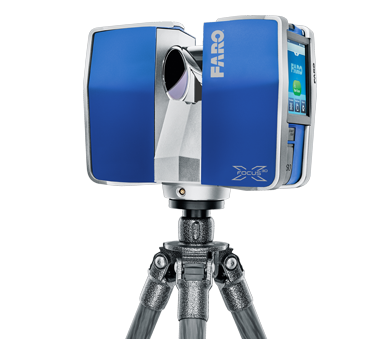
The Faro Laser Scanner is capable of obtaining millions of points in 3D space in a few minutes, to create a complete 3D image of any object. Normally a 50' yacht hull be scanned in 1-2 hours with around 8-10 individual scans.
The scan points are post-processed to create a point cloud which can then be messed, surfaced and modelled. The Faro is light and portable, so it is ideal for interiors and tight spaces.
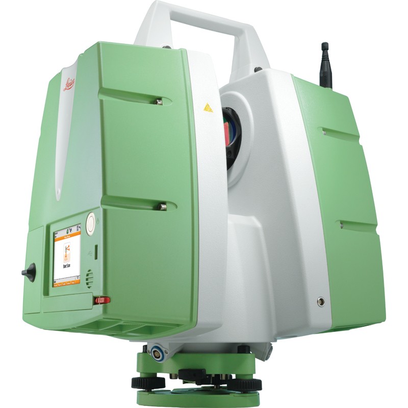
Our Leica C10 is a powerful, fast and accurate long range scanner, and combined with Leica’s Cyclone software, provides an excellent platform for large structures.
Both scanners incorporate cameras, which can give a full 360-degree view of the scanned objects. The colours from the photography can be assigned to the points, which can then make the point cloud easier to interpret.

